+44 (0) 1273 513 881 [email protected]
![]()
![]()
![]()
+44 (0) 1273 513 881 [email protected]
![]()
![]()
![]()
Position: 50° 46'.20N., 00° 03'.70E. (ETRS 89 Datum)
Tel: 01273 513881
Suitable charts: Stamfords No 9. Admiralty No 1652, 2154, Imray C9.
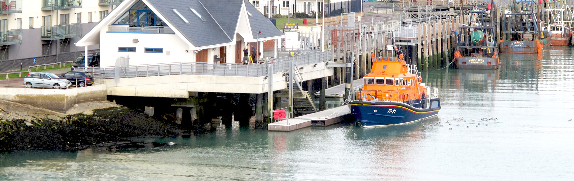
In strong on-shore winds there is often a difficult sea at the entrance of the harbour with breaking seas on the eastern side of the dredged channel. Yachts are advised to pass close to the breakwater in these conditions.
Position: 50° 46'.92N., 00° 03'.42E. (ETRS 89 Datum)
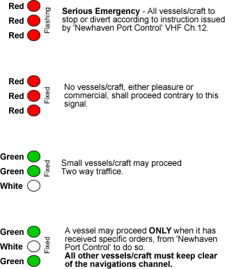
There are traffic signal lights and marks displayed from a tower on the western side of the river:
Position: 50° 46'.27N., 00° 03'.23E. (ETRS 89 Datum)
When red lights are showing on signal mast, situated at the North End corner of the marina, no vessel(s), commercial or pleasure, may leave any part of Newhaven Marina.
Failure to comply with the 'Vessel Traffic Signals', could place people and vessels in danger and may therefore result in prosecution and/or termination of your berthing agreement/future use of Newhaven Harbour.
Position: 50° 47'.69N., 00° 03'.14E. (ETRS 89 Datum)
Call sign - 'Newhaven Bridge Control'
VHF Ch. 12
If you proceed up river beyond Newhaven Marina there are regulations and signals at Newhaven Swing Bridge.
For further information please contact the Port Authority Operations Department:
Harbour Authorities
Harbour Master: Capt.Dave Collins-Williams
01273 612868
Position: 50° 47'.39N., 00° 03'.25E. (ETRS 89 Datum)
When red lights are showing on signal mast, situated at the North West corner of No2 Ro-Ro Pontoon, no vessel(s), commercial or pleasure, may proceed South past these lights.